Helderse Duinen
Den Helder Zuid → Den Helder
Hiking in and around Den Helder?! Absolutely. Those who travel to the tip of Noord-Holland are rewarded with a surprisingly versatile route. From winding paths through the dunes to perfectly straight dikes along the sea. Along the way, you'll pass robust forts, museums, a lighthouse, and end up in the city center with plenty of catering establishments.
Up to 3 photos. We resize them automatically so phone photos work fine.
The map shows the main signposted route. Variants follow the same trail with shortcuts or extensions — see Practical info and Route notes for details.
Highlights
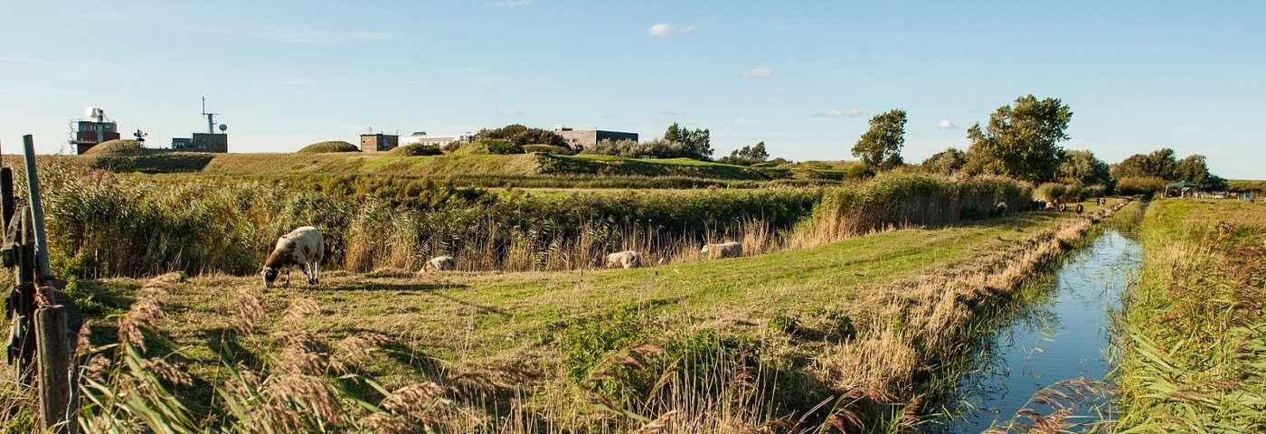
- Over 5 km of unpaved walking through the dunes
- Get a breath of fresh air by the sea
- Helderse Vallei Visitor Center, Fort Kijkduin, Marine Museum, Rescue Museum
- Renovated city center of Den Helder with catering, harbors, shops
Practical info
- Distance
- 9.5 km, 14 km or 15.5 km
- LAW
- Wandelnetwerk Noord-Holland
- Paved percentage
- 33%
- Dogs allowed?
- Yes. Yes, dogs are allowed on a leash, but prohibited in the Nollen area (beginning of the route, alternative is indicated).
Description
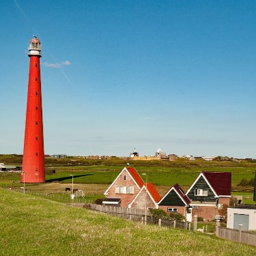
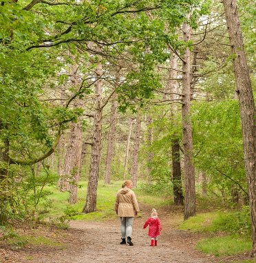
This varied route starts at Den Helder Zuid station; easily accessible because Intercity trains stop there. From the station, you dive into nature reserve De Nollen; next to it is the acclaimed art project De Nollen by Rudi de Wint. In the Helderse Duinen, you follow unpaved paths through dune valleys and pine forests. From the 15-meter-high watchtower, you can overlook the entire area. Further on is Fort Kijkduin with a museum and sea aquarium. The catering establishments – right by the sea – beckon. Then you pass Lange Jaap lighthouse and meander along the canal of Fort Erfprins to the sea dike. Time to get a breath of fresh air! Crashing waves, screaming seagulls, and on the horizon, the ferry shuttling back and forth to Texel. The city center of Den Helder exudes a maritime atmosphere: the Marinemuseum, the harbors with modern yachts and historic ships. And let's not forget the beautifully renovated, car-free quay along the canal where it's pleasant to relax on a terrace. A worthy endpoint of this route.
Route
The walking route from Den Helder Zuid station to Den Helder station is 15.5 km. There are various options to shorten the route along the way.
In summer (mid-July to end of Aug.), the Kustbus, line 851, runs to and from Den Helder station. For example, start the route after 4 km at bus stop Donkere Duinen, or after 7 km at Fort Kijkduin. Current times are available on kustbus.nl.
You can also take bus line 30 or 31 to the station after 9.5 km at stop Noordwest Ziekenhuisgroep (daily, several times per hour). Or after 14 km, at the ferry terminal, take line 33 to Den Helder station (stop TESO jetty or stop Marinemuseum).
Photos from NS
Photos © NS · sourced from ns.nl