Valkenburg aan de Geul
Maastricht → Valkenburg
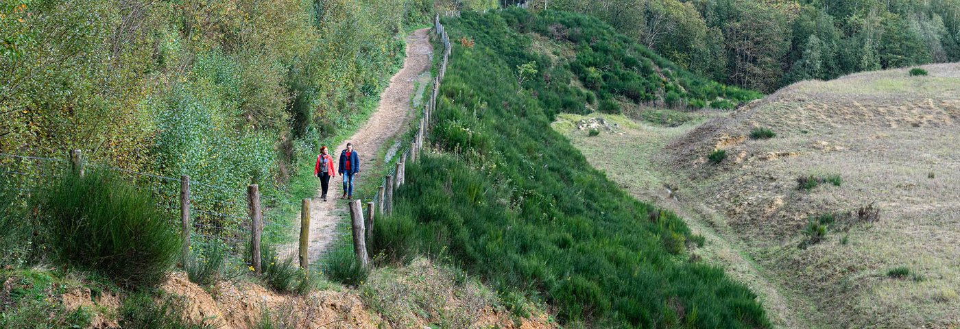
Where highway traffic once roared straight through Maastricht, you can now walk peacefully along the Groene Loper – a green ribbon of footpaths and cycle paths – out of the city. After about an hour, you'll find yourself in the Limburg hills. Via forests, fields, an old marl quarry, and the idyllic Geuldal, you'll reach Valkenburg aan de Geul, which was named 'hiking municipality of the year' in 2019.
Up to 3 photos. We resize them automatically so phone photos work fine.
The map shows the main signposted route. Variants follow the same trail with shortcuts or extensions — see Practical info and Route notes for details.
Highlights
- The Geul and the Geuldal
- The Curfsgroeve, an old marl quarry, now a nature reserve; steep stairs and viewpoint
- The lively city center of Valkenburg with museums, caves, wellness, and catering
- Castles in the Geuldal
Practical info
- Distance
- 13 km or 17 km
- LAW
- Krijtlandpad
- Percentage paved
- 50%
- Dogs allowed?
- Yes. Dogs are allowed on a leash.
Description
Start your day well with a relaxed intercity train journey to Maastricht. Once there, you can enjoy a delicious Limburgse vlaai in the cafe opposite the station. This way, you'll immediately feel at home in the Burgundian south. After that, it's time to set off.
From Maastricht station, you walk out of the city alongside the greenery of trees and parks. And then, past the last buildings, you'll find yourself in the Limburg hills with rolling fields and unpaved paths.
In the middle of the forest, you suddenly stand at the edge of the Curfsgroeve. Marl used to be quarried here. Now it is a nature reserve with special animals and plants. Descend to the Geulhemermolen and the Geul. You follow the winding river all the way to Valkenburg. Time to relax on a terrace. The main route ends at the station, but you can also continue to follow the Geul through a wooded valley to Schin op Geul.
The path is approximately 50% paved (to Valkenburg); extension to Schin op Geul approximately 30%.
Route
The hiking route from Maastricht station to Valkenburg station is 13 km. You can extend the route by 4 km by walking further to Schin op Geul (17 km total). There are no options to shorten the route along the way.
Check current train times in the NS-app or in the Reisplanner on NS.nl.
Photos from NS

Photos © NS · sourced from ns.nl