Hemelse Berg
Oosterbeek → Arnhem Centraal
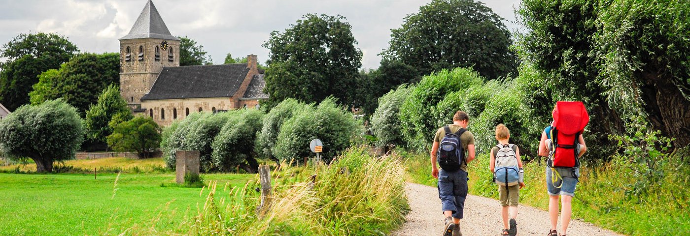
Between Oosterbeek and Arnhem lies a beautiful hiking area: the Hemelse Berg. But also: Heveadorp, Duno estate, Westerbouwing and Mariëndaal estate. Walk up and down through the woods, enjoy the view over the Rhine, stroll through the floodplains. Time left? Then visit the center of Arnhem.
Up to 3 photos. We resize them automatically so phone photos work fine.
The map shows the main signposted route. Variants follow the same trail with shortcuts or extensions — see Practical info and Route notes for details.
Highlights
- Estates
- Floodplains and river
- Elevation changes
- Green city Arnhem
Practical info
- Distance
- 5 km, 7 km or 16.5 km
- LAW
- Rijndeltapad, Maarten van Rossumpad
- Dogs allowed?
- Yes. Dogs are allowed on a leash.
Description
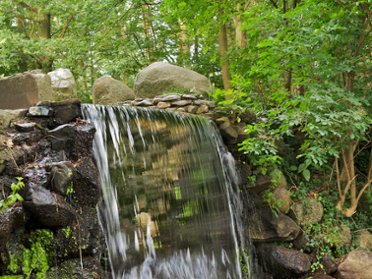
You first pass Villa Hartenstein, formerly the headquarters of Operation Market Garden, now the beating heart of the Airborne Museum. Then follows the Hemelse Berg with its beautiful stream, the English houses in Heveadorp, Duno estate and the Westerbouwing with views over the river. Near the church of Oosterbeek you enter the floodplains. Finally, Mariëndaal estate and for those who wish, the center of Arnhem.
Route
You can shorten the route by 4.5 km by taking bus line 51 from Arnhem station to Heveadorp; get off at the Beeklaan stop (Mon-Sat 2x per hour, Sun 1x per hour).
Bus line 51 also stops at the Drielse Veer stop, Oosterbeek; if you take the bus there, the route is 9 km. Those who cut the route short at this stop will have walked 6 km.
After 7 km you can take bus line 51 from bus stop Oude Kerk, Oosterbeek to Arnhem station. The reverse is also possible: from Arnhem station take bus line 51 to bus stop Oude Kerk, Oosterbeek. The route is then 8 km long.
Along the Utrechtseweg, right through Oosterbeek, bus line 1 runs to Oosterbeek station and bus lines 1 and 352 run to Arnhem station. Check current departure times in the NS app or in the Reisplanner on NS.nl (including bus times).
Photos from NS
Photos © NS · sourced from ns.nl