De Vuursche
Baarn → Hollandsche Rading
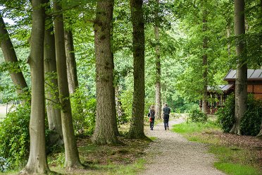
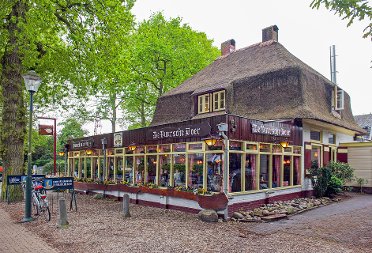
In the 17th century, this was still an extensive heathland area. Until all sorts of country estates arose with lush gardens and beautiful park forests. Now you walk in forests where monumental trees and old beech avenues are hidden. In the forest village Lage Vuursche, will you choose pancakes or 'poffertjes'?
Up to 3 photos. We resize them automatically so phone photos work fine.
The map shows the main signposted route. Variants follow the same trail with shortcuts or extensions — see Practical info and Route notes for details.
Highlights
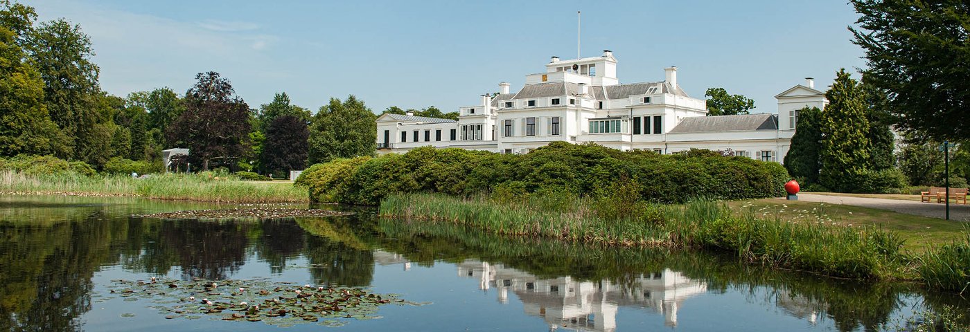
- Paleis Soestdijk
- Lage Vuursche
- De Hollandsche Rading (on the border between Utrecht and Holland)
Practical info
- Distance
- 9 km or 13 km
- LAW
- Utrechtpad
- Dogs allowed?
- Yes. On a leash. Please note oversteps.
Description
In the 17th century, De Vuursche was an extensive heathland area, but the construction of country estates led to the creation of lush gardens and beautiful park forests here. Monumental trees and old beech avenues are now hidden in younger forests. Along heathland De Stulp and the Pluismeer you reach the forest village Lage Vuursche. Through the Maartensdijkse Bos you reach Hollandsche Rading. Boundary markers recall this border between Utrecht and Holland, which was formerly the cause of various conflicts.
Route
Shorten to 9 km: from Lage Vuursche (Dorp stop) take bus line 59 to Hilversum or Den Dolder station. The bus runs 1 time per hour from Monday to Friday. The bus does not run on Saturdays and Sundays.
Photos from NS
Photos © NS · sourced from ns.nl